Home » Academic projects » Landscapes of Eruptions and Depositions: Soil Recognition Patterns at the Fyli Landfill | Architecture Thesis on Regenerative Architecture
Landscapes of Eruptions and Depositions: Soil Recognition Patterns at the Fyli Landfill | Architecture Thesis on Regenerative Architecture
Excerpt: ‘Landscapes of Eruptions and Depositions: Soil Recognition Patterns at the Fyli Landfill’ is an architecture thesis by Areti Miza from the ‘School of Architecture – Technical University of Crete’ that explores regenerative architecture for dealing with waste. The project aims to integrate discarded items into social possibilities, transitioning from collapse to emergence, excavation to accumulation, and minimal to abundant. It challenges boundaries between natural and built environments and encourages us to reconsider the landscape on a larger scale.
Introduction: The architecture thesis analyses the current ecological and geological crisis through the lens of material interdependence and exhaustion, based on previous research, Body and Territory in Reciprocal Breaking and Assemblage (2021). Complex relationships between geological and physical materialities reveal new geological landscapes that are on the brink of destratification and exhaustion.
If Anthropocene narratives explore the boundaries of ungrounding, this study starts from an opposite stance: earthly repositioning or re-stratification. We are living in a geological age characterised by the accumulation of waste, which is the result of earlier actions taken to extract raw materials and useful energy from the earth’s body. These burial and deposition landscapes, which are formed by continuous energy and transformation flows, constitute a critical crisis zone.
In light of the Fyli landfill site in Athens’ northwest urban periphery, different approaches to relating to the abject are explored. In particular, the landfill is considered as a liminal zone of conceptual and spatial contradictions between the “natural” and the damaged, the hypertrophic and the anorexic, the ordered and the unordered. A HYPER-place, which is defined by constant expansion and boundary changes, simultaneously establishes its territory and erases it through the opposing processes of excavation and infilling. In this situation, dirt and order are completely interdependent and invisible.
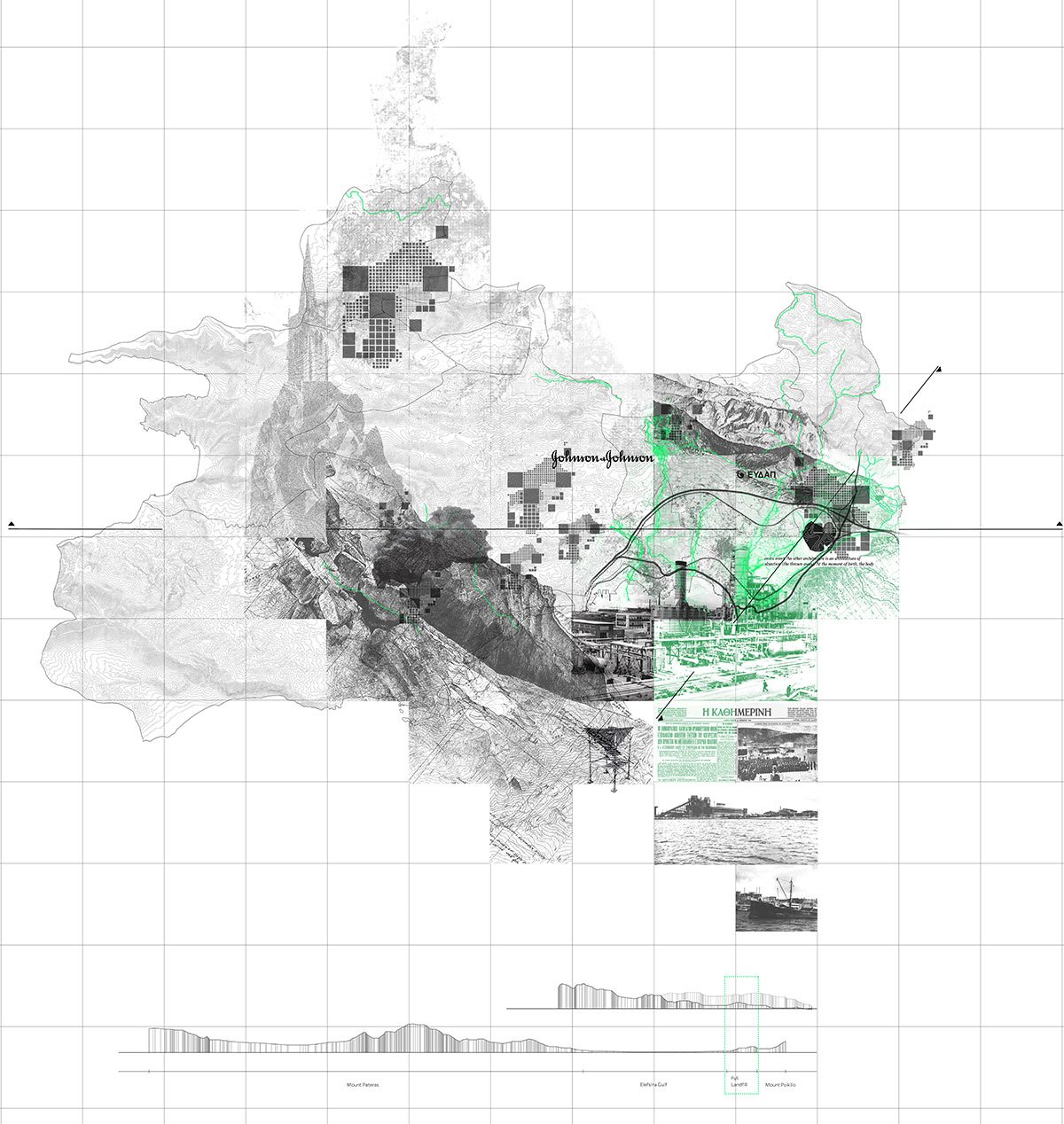
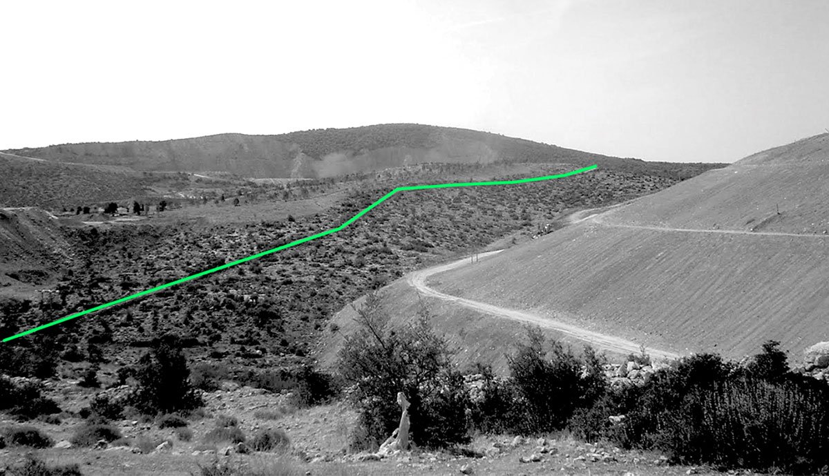
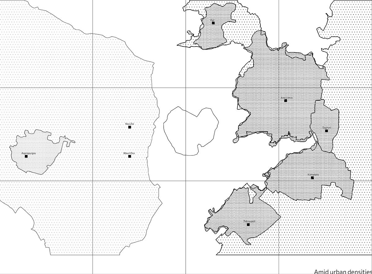
Wider Area AnalysisIntroducing the Landfill: A Place in Between | Relations of Contradiction
The landfill acts as a catalyst for exploring and comparing the domains of waste, the city, society, pollution and ecology, limits and flows, minimalism and exuberance, enabling us to explore a variety of interconnections between these elements.
Introducing the Landfill: A Place in Between | Relations of ContradictionIntroducing the Landfill: A Place in Between | Relations of ContradictionIntroducing the Landfill: A Place in Between | Relations of ContradictionIntroducing the Landfill: A Place in Between | Relations of Contradiction
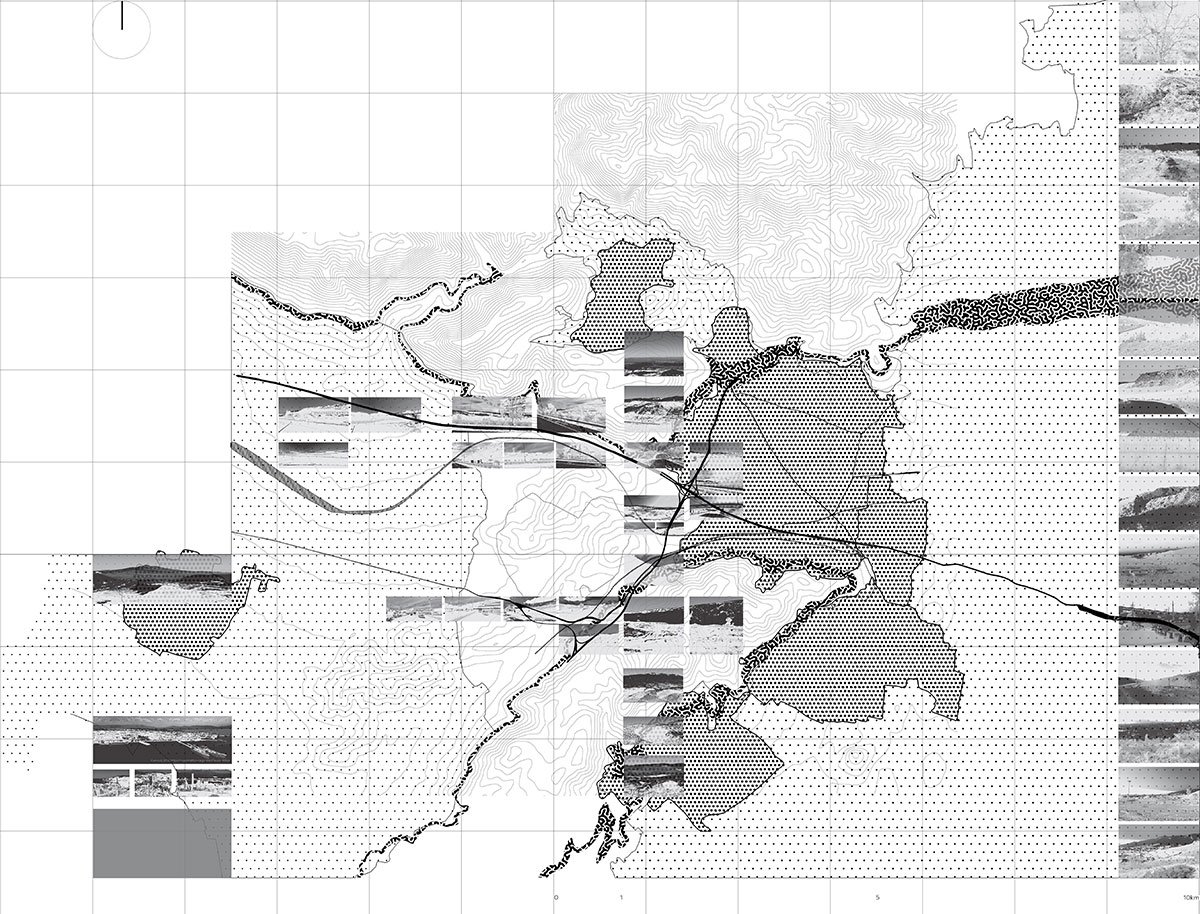
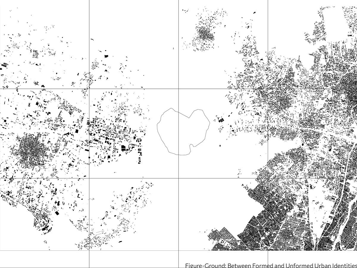
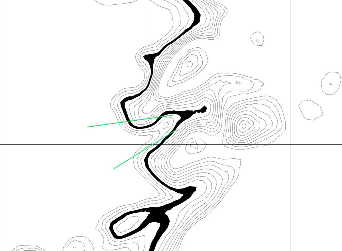
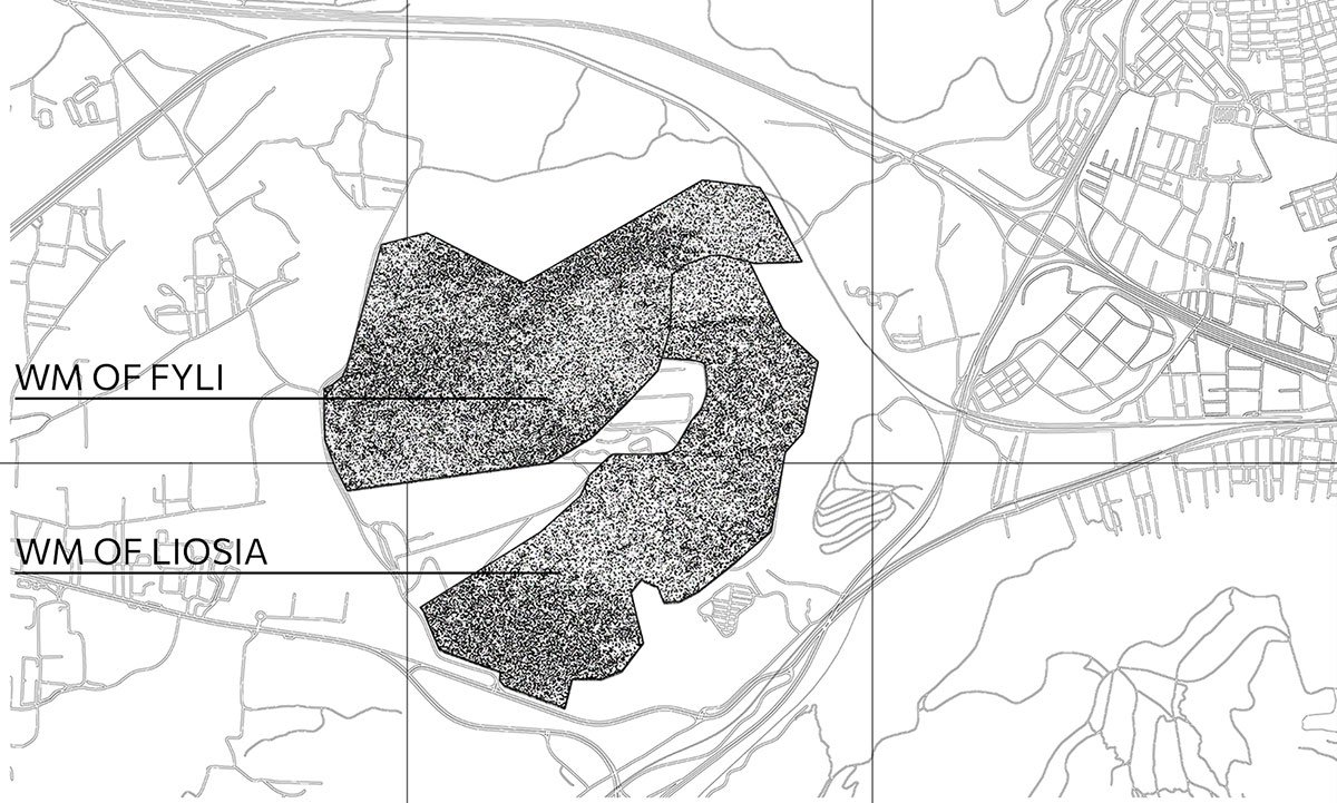
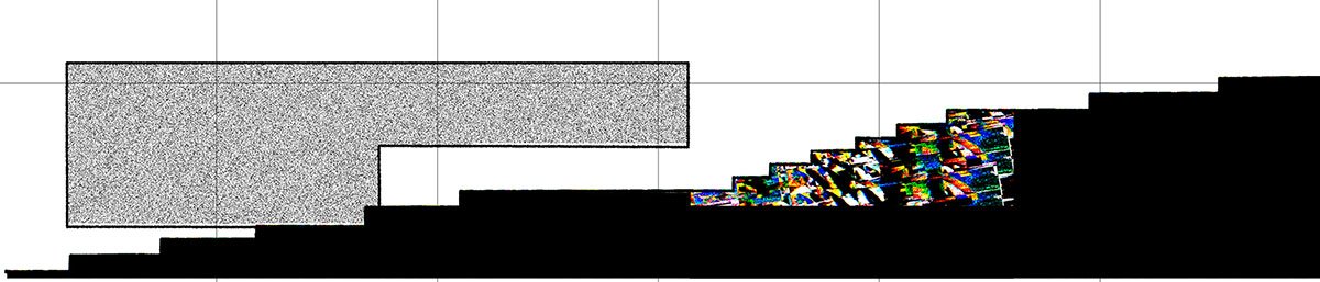
An analysis of the broader region reveals that high-impact activities disproportionately affect the western portion of Attica, especially the Thriassio Plain. The study area serves as a boundary between established, dense urban identities and more fluid, industrialized local physiognomies. Large volumes of waste are deposited between Mount Aigaleo and Mount Parnitha, which form a vertical geological continuum. At the same time, the landfill is further isolated by the passage of major highways and railway lines.
Introducing the Landfill: A Place in Between | Relations of ContradictionIntroducing the Landfill: A Place in Between | Relations of ContradictionIntroducing the Landfill: A Place in Between | Relations of Contradiction
In this anarchic, industrial setting, the landfill is more than 1,000 hectares in size, 500 meters deep, and continually expanding as it has been receiving 7,000 tonnes of garbage every day since 1960, which includes all of Attica’s municipal waste. This area is characterised by a stretching of boundaries, which can lead to disintegration but also open up new possibilities.
Introducing the Landfill: A Place in Between | Relations of Contradiction
The goal is an alternative integration with the things we discard—an experiment in reimagining social possibilities—and this signifies a transition from collapse to emergence, from excavation to accumulation, and from the minimal to the abundant.
Design Process
Geological Skin: Relief Disturbances, Excavation and Accumulation in the Soil – a sacrificed land –Geological Skin: Relief Disturbances, Excavation and Accumulation in the Soil – a sacrificed land –Geological Skin: Relief Disturbances, Excavation and Accumulation in the Soil – a sacrificed land –
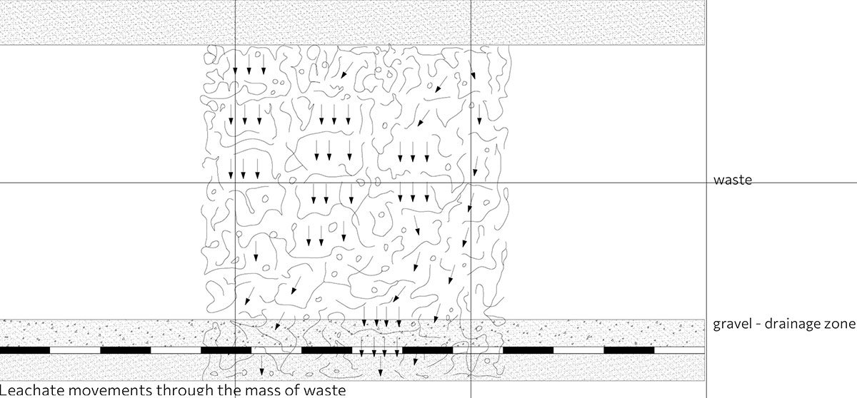
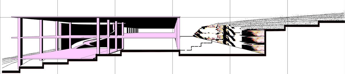
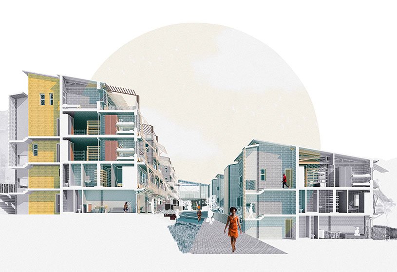
Based on the above, this work explores various approaches for dealing with waste. It proposes the establishment of an above-ground network designed to prevent leachate leakage. This network serves as a mechanism that dismantles and reinterprets existing conditions and their interrelationships. It is composed of the essential elements required for waste processing.
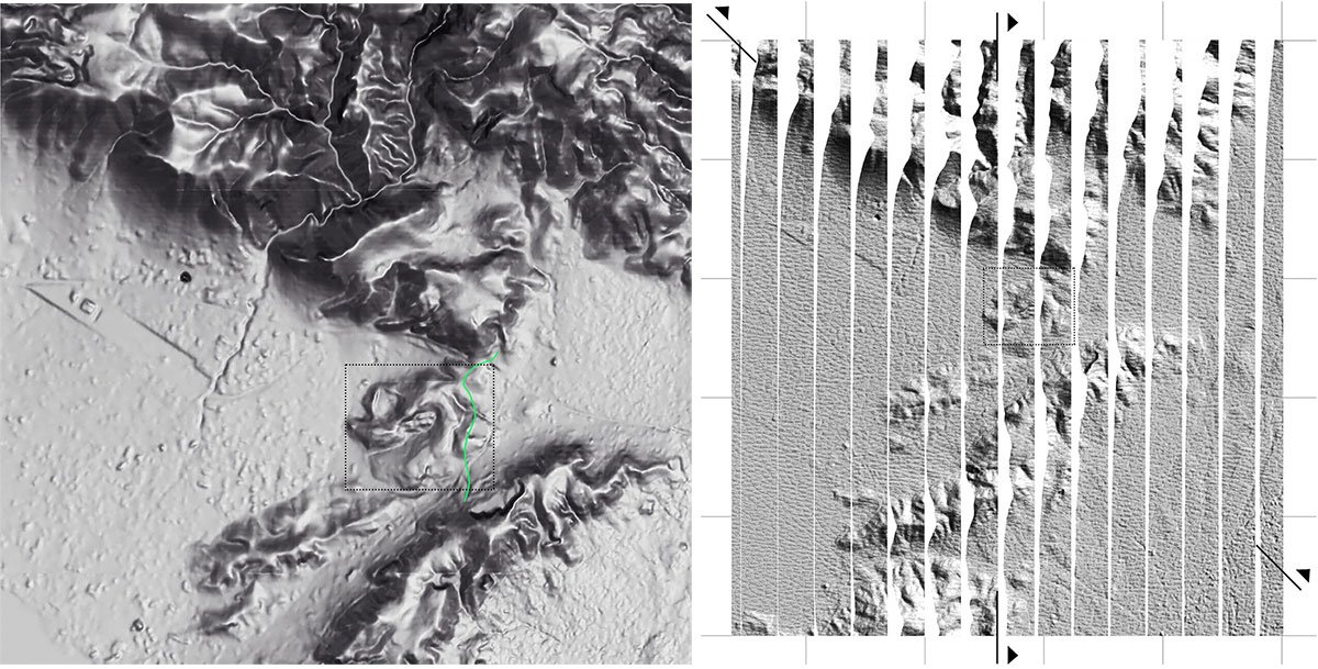
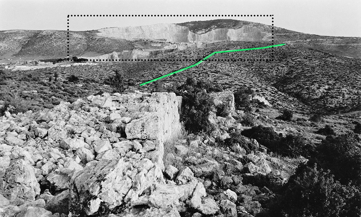
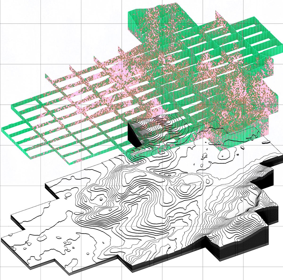
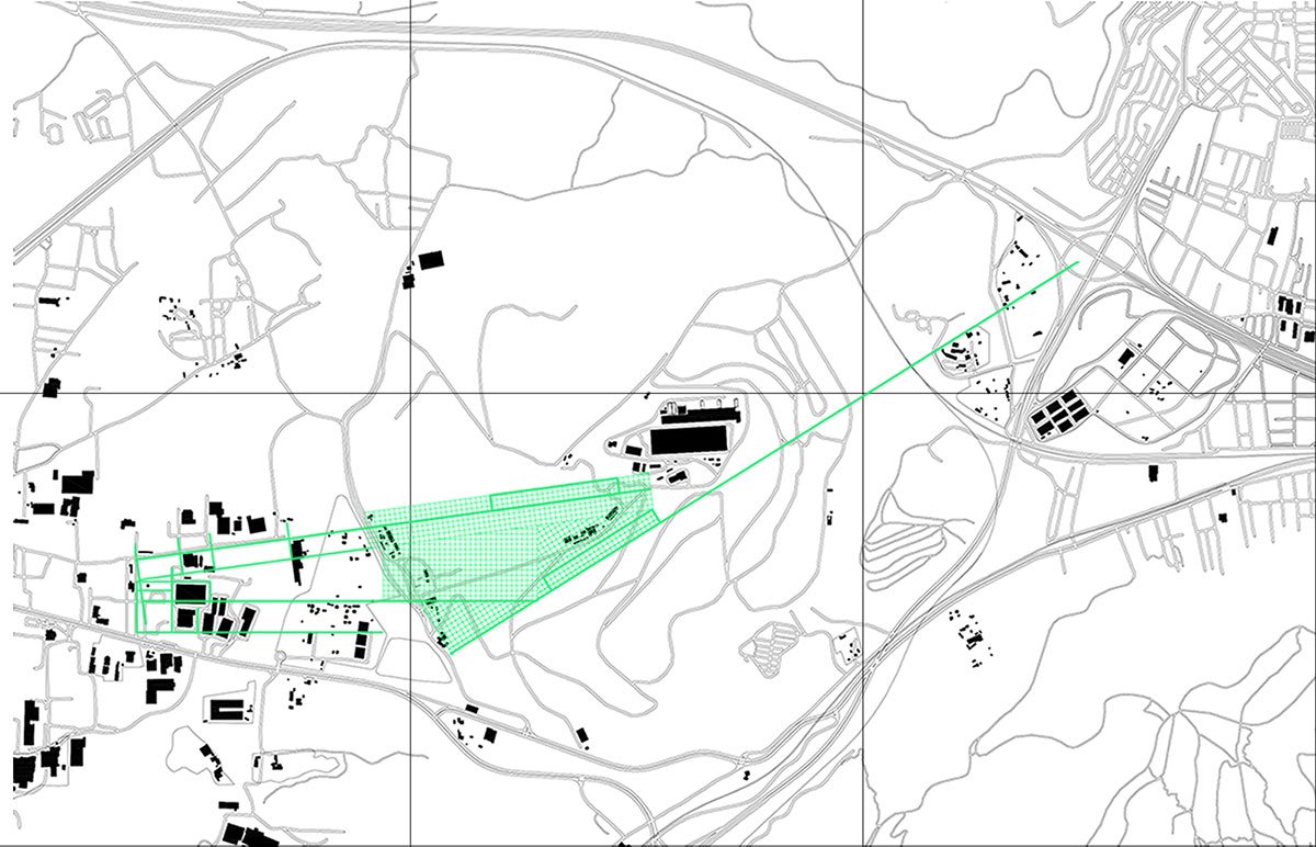
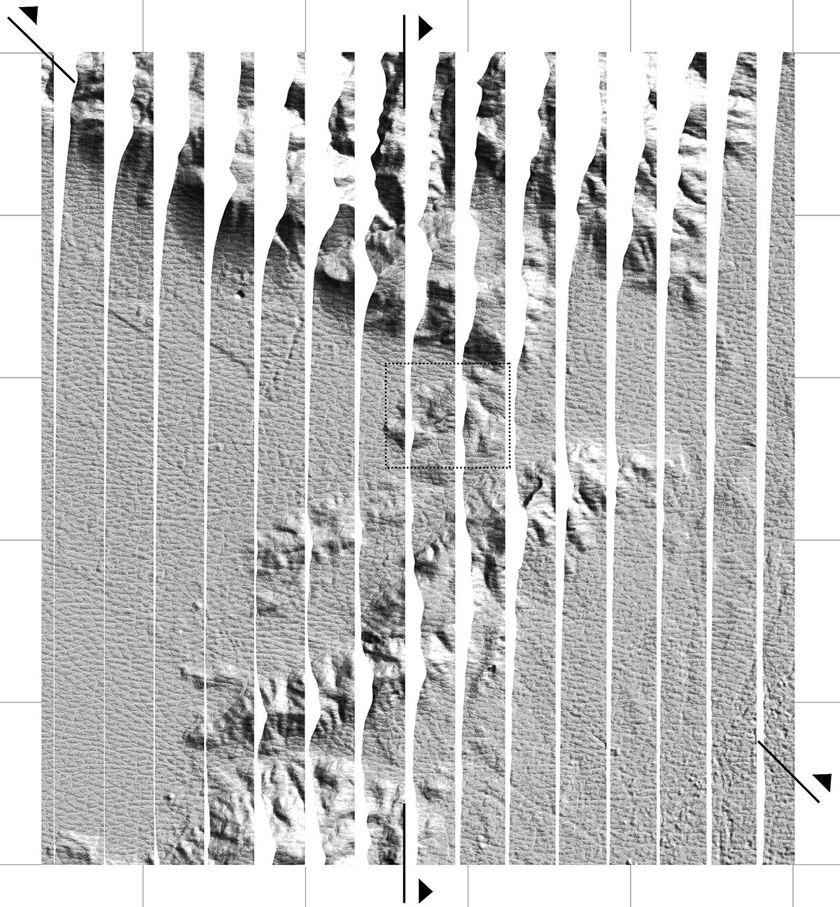
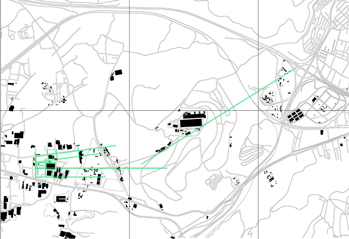
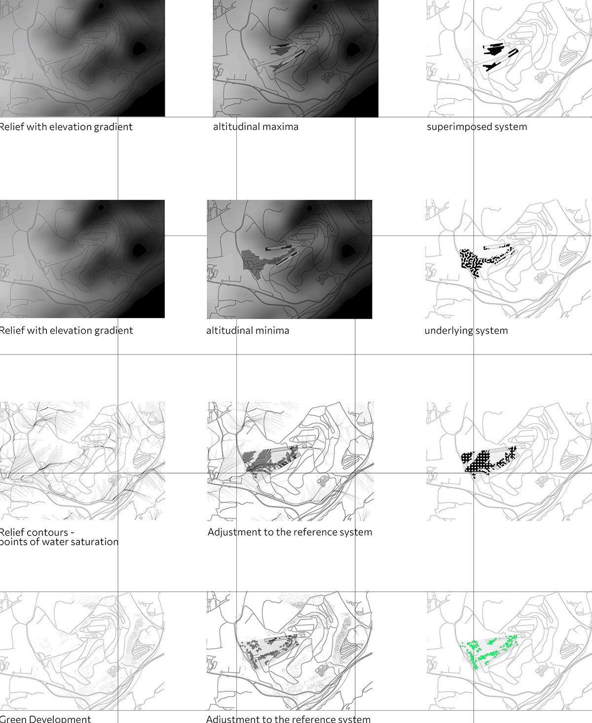
Geological Boundaries between Parnitha and Poikilo MountBoundaries between the Fyli Waste Management Facility and the Liossia Waste Management Facility – Between the “old” and “new” Waste Management AreasChange in size and inclination of the grid: Grid 1 -> WM of Fyli | Grid 2 -> WM of Liosial | Grid 3 -> While the system is more enclosed in the east, to the west we have free and scattered waste; an attempt is made to establish a kind of order that will coexist with the chaos between the two structures.
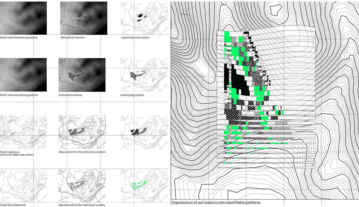
Points of retreat of existing boundaries serve as a guide for the placement of the structures. Three distinct alignments have emerged as a result of the geological boundaries between Parnitha and Poikilo, the lines dividing the “old” and “new” waste management areas, and the constraints placed on the accumulation structures to the west by the existing organisational structures. These alignments use three distinct grids to create a network that serves as the proposal’s reference system.
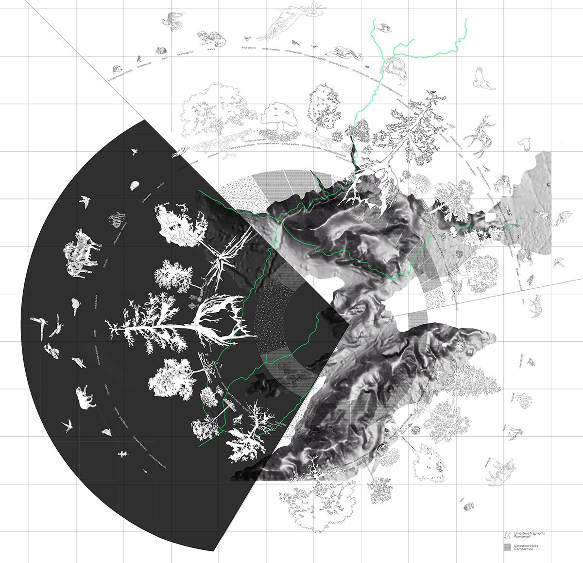
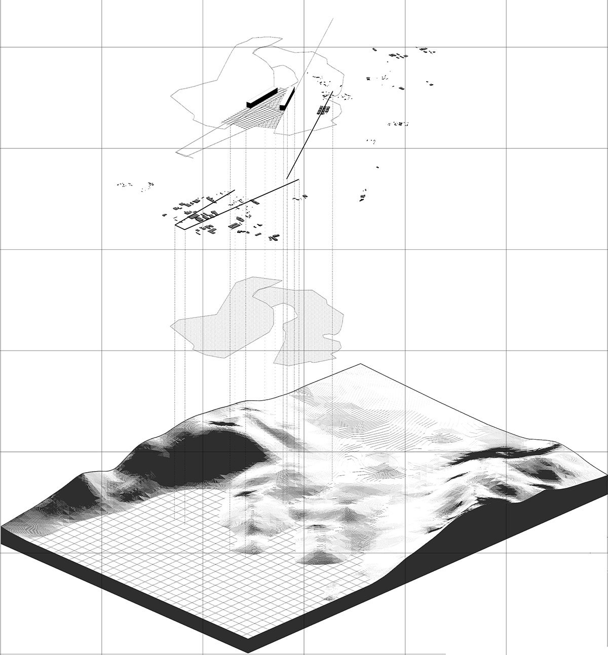
Spatial Tools and StrategiesSpatial Tools and StrategiesSpatial Tools and Strategies
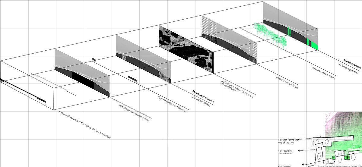
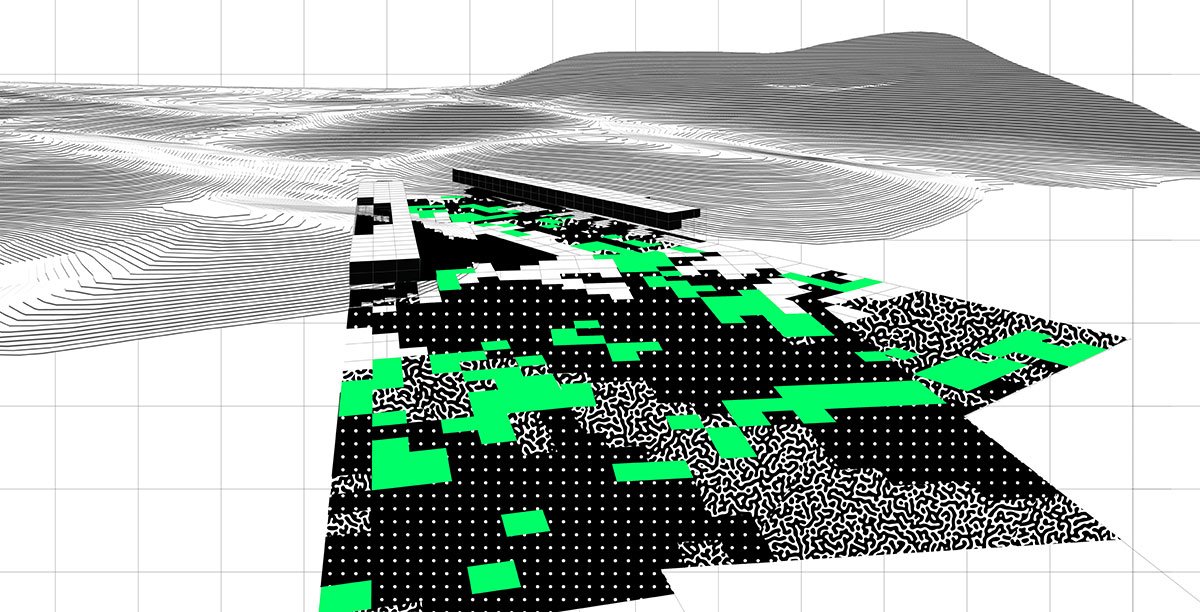
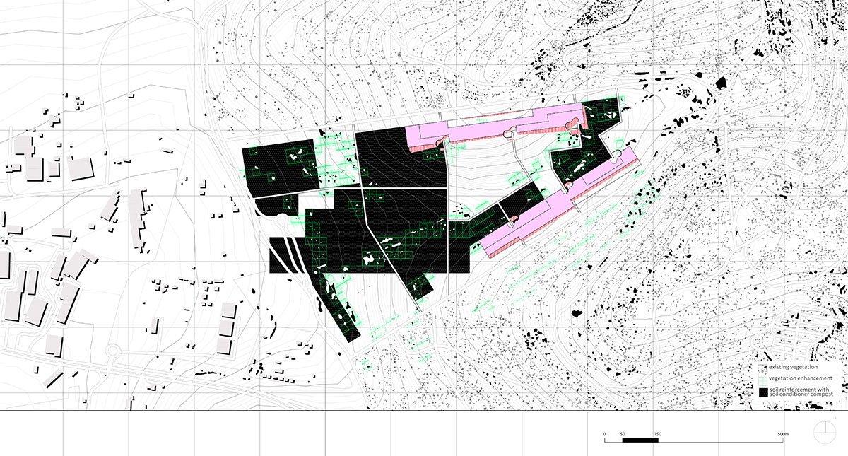
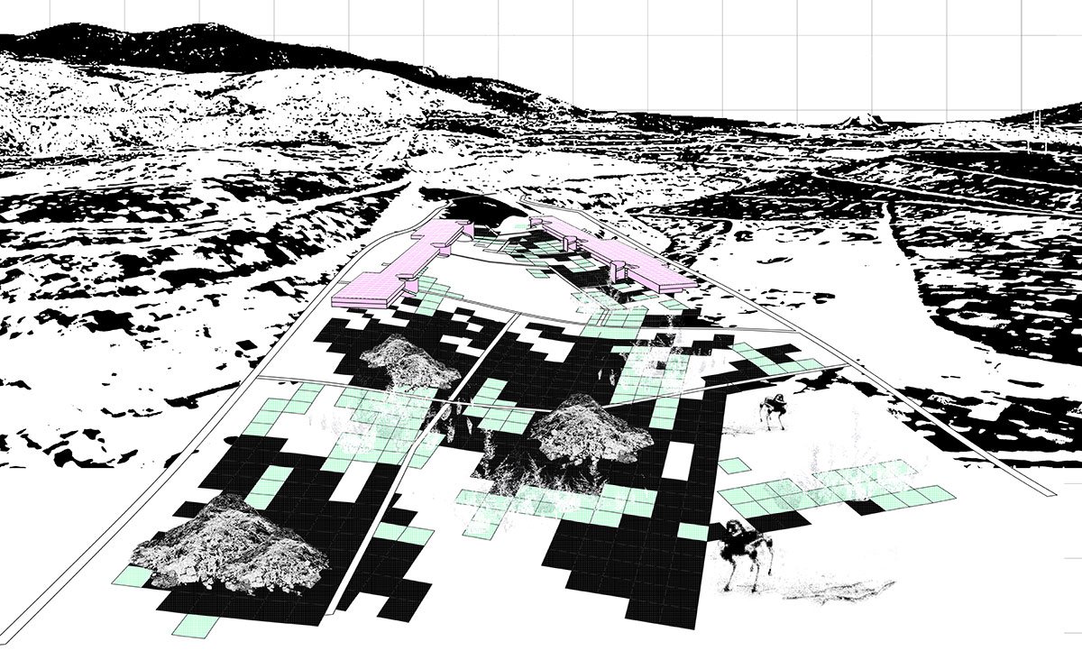
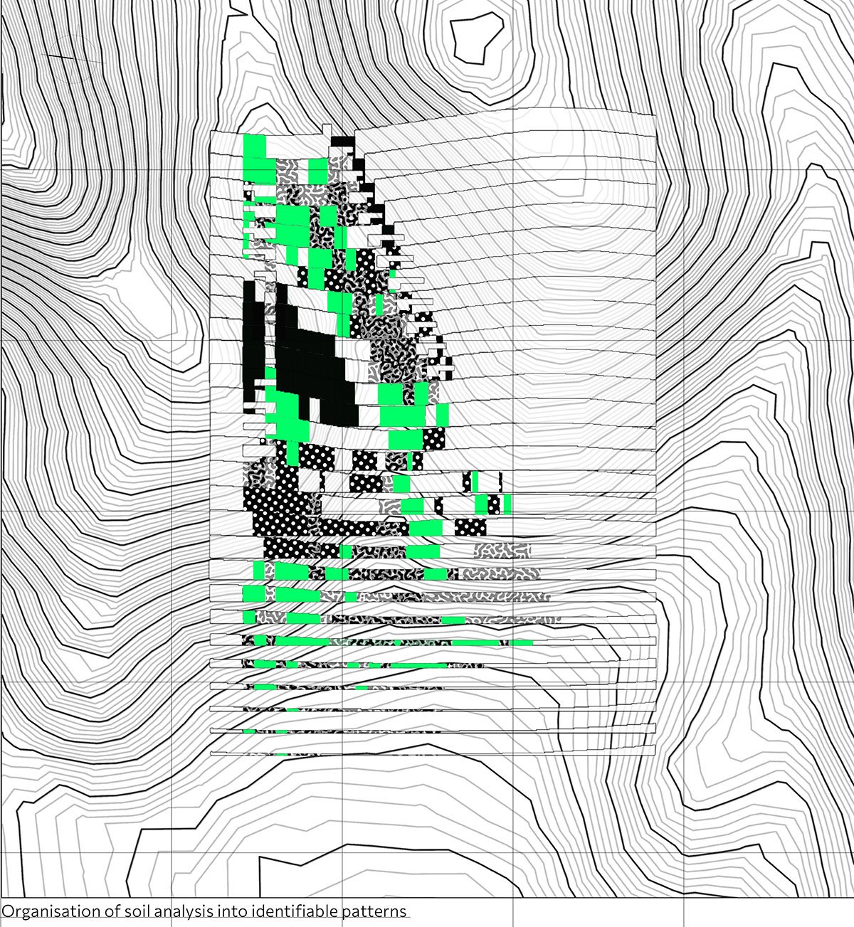
In accordance with this recently created gridded network, the topography analysis—which includes maximum and minimum elevations, humidity concentration points, and regions of vegetation growth—offers a new perspective on the land. In this case, all of the conditions found in the grid are improved in terms of soil structure, and all of the conditions associated with the formation of structures are reversed. Consequently, green systems have been revitalised, enhanced soils through compost, volume overlays in low-topography regions, and volume removals at points of maximum elevation.
Final Outcome
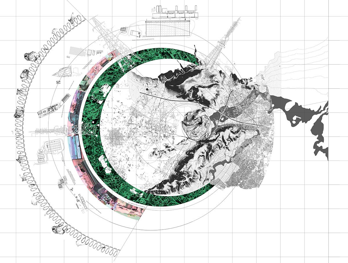
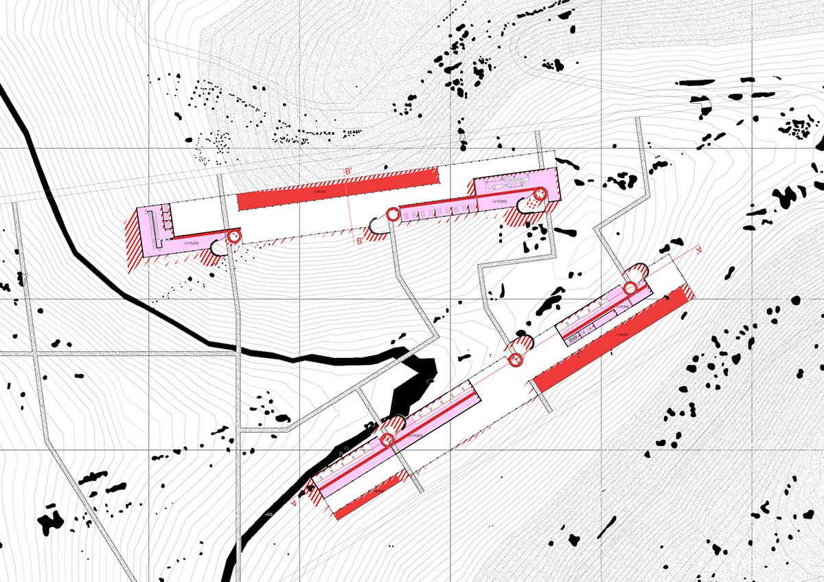
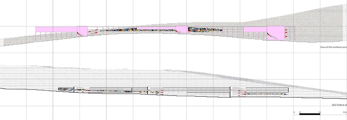
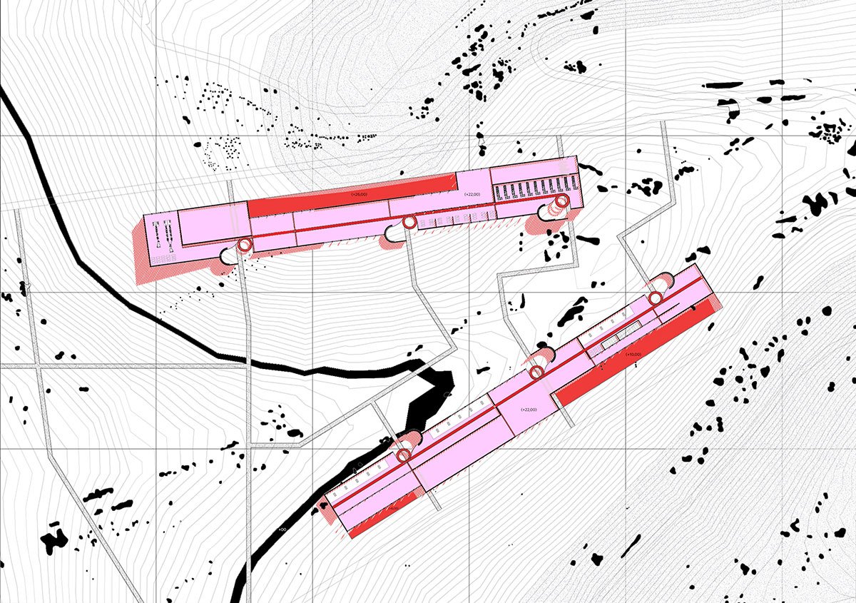
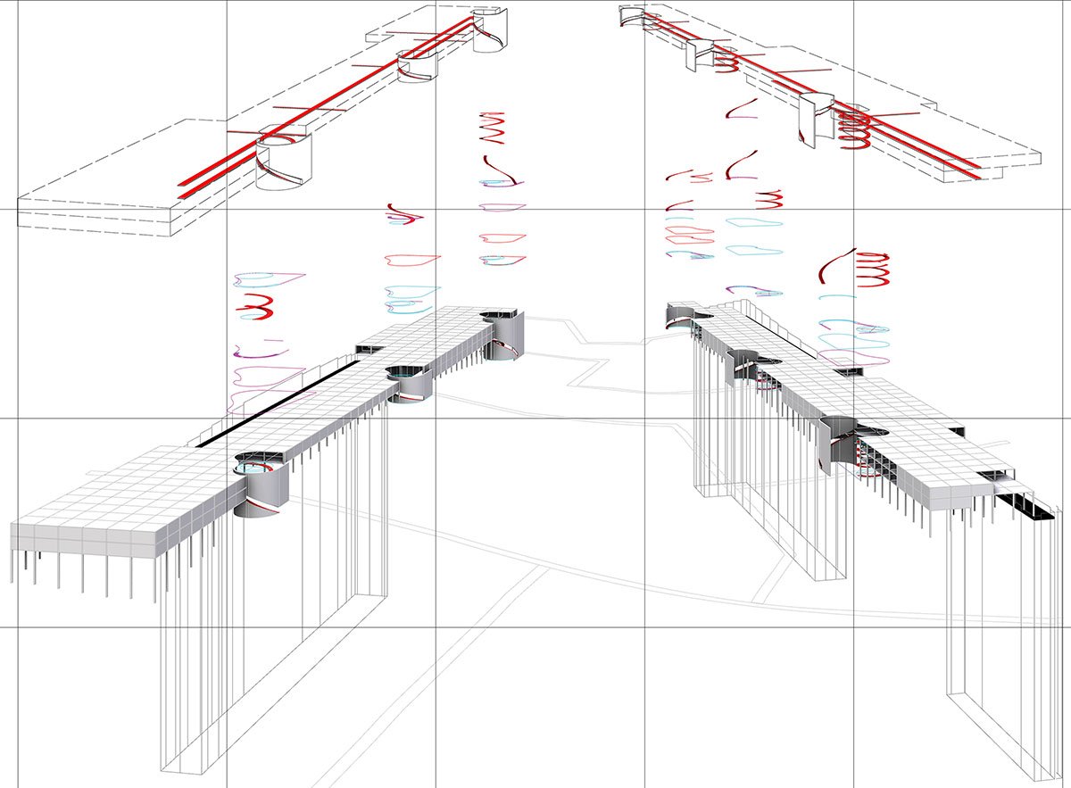
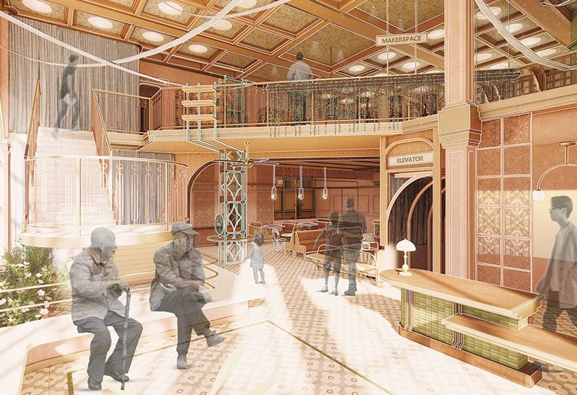
Masterplan 1:5000A Level +17mElevation And SectionDevelopment of Subsystems
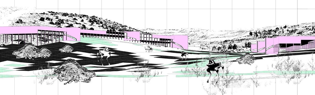
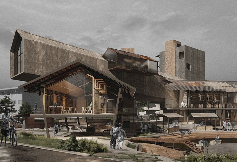
The two proposed structures seek to respond to the scale of the surrounding earth and its internal variations through patterns of recognition of the existing terrain. They embody a logic of complete void by attempting to extend the boundary, and the structures that emerge are the absolute totality that is shaped and influenced by the things they come into contact with. Every subsystem of the analysis exists and develops as a latent microcosm within the solid volumes.
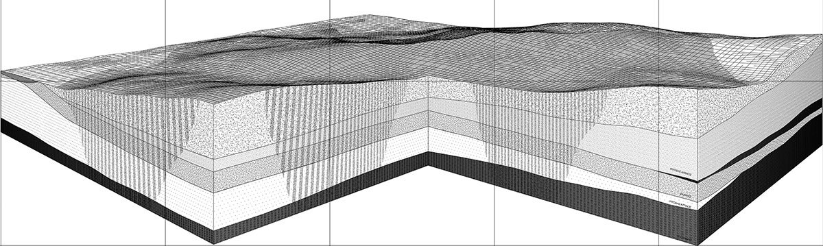
B Level +22mExisting Terrain | Layers of WasteNew Territory – Resulting from SubtractionTop-Surface
More precisely, the two linear sequences—which follow the logic of an inverted quarry—are dedicated to geological changes and themselves. They incorporate three distinct types of soils: the existing soil, the one resulting from excavation, and the soil that forms the space’s upper layer.
Joining Three Territorial Conditions: Top-Surface, Subtraction, ExistingRelationship Between Organised and Disorganised Discharge Within Structure/Within Geological StrataSystem CompositionFocus On B Level: Scale 1/1000
The incisions in the terrain reveal an archaeology of waste, juxtaposing this proposal with the former waste-producing landscape. In this way, an exchange unfolds between disorganized waste disposal within geological strata and organized processing within the structures. There is an allusive dialogue between excavation and filling, between integrity and residue, and between projection and elimination. Another aspect of surplus production is revealed at the intersection: the disassembly and reassembly process.
Movement Of Waste | Ascent – Excavation RatioSystem Composition
Conclusion: The two monument-like bars serve as dynamic interventions within the landscape, interacting with the geological features while asserting a strong presence. They function as artificial sections that redefine the spatial scale and challenge the boundaries between the natural and built environments. They impose a new reality that encourages us to reconsider the landscape on a larger scale.
[This Academic Project has been published with text and images submitted by the student]
Site Context
Design Process
Final Outcome
To submit your academic project for publication at ArchiDiaries, please visit the following link >> Submit
Get the best of ArchiDiaries, directly in your inbox.
We use cookies on our website to give you the most relevant experience by remembering your preferences and repeat visits. By clicking “Accept All”, you consent to the use of ALL the cookies. However, you may visit "Cookie Settings" to provide a controlled consent.
This website uses cookies to improve your experience while you navigate through the website. Out of these, the cookies that are categorized as necessary are stored on your browser as they are essential for the working of basic functionalities of the website. We also use third-party cookies that help us analyze and understand how you use this website. These cookies will be stored in your browser only with your consent. You also have the option to opt-out of these cookies. But opting out of some of these cookies may affect your browsing experience.
Necessary cookies are absolutely essential for the website to function properly. These cookies ensure basic functionalities and security features of the website, anonymously.
Cookie
Duration
Description
cookielawinfo-checkbox-analytics
11 months
This cookie is set by GDPR Cookie Consent plugin. The cookie is used to store the user consent for the cookies in the category "Analytics".
cookielawinfo-checkbox-functional
11 months
The cookie is set by GDPR cookie consent to record the user consent for the cookies in the category "Functional".
cookielawinfo-checkbox-necessary
11 months
This cookie is set by GDPR Cookie Consent plugin. The cookies is used to store the user consent for the cookies in the category "Necessary".
cookielawinfo-checkbox-others
11 months
This cookie is set by GDPR Cookie Consent plugin. The cookie is used to store the user consent for the cookies in the category "Other.
cookielawinfo-checkbox-performance
11 months
This cookie is set by GDPR Cookie Consent plugin. The cookie is used to store the user consent for the cookies in the category "Performance".
viewed_cookie_policy
11 months
The cookie is set by the GDPR Cookie Consent plugin and is used to store whether or not user has consented to the use of cookies. It does not store any personal data.
Functional cookies help to perform certain functionalities like sharing the content of the website on social media platforms, collect feedbacks, and other third-party features.
Performance cookies are used to understand and analyze the key performance indexes of the website which helps in delivering a better user experience for the visitors.
Analytical cookies are used to understand how visitors interact with the website. These cookies help provide information on metrics the number of visitors, bounce rate, traffic source, etc.
Advertisement cookies are used to provide visitors with relevant ads and marketing campaigns. These cookies track visitors across websites and collect information to provide customized ads.