Excerpt: ‘Memoir: After the Neoliberal Flood’ is an architecture thesis by Ceylin Çelimli and Ece Engin from the ‘Faculty of Architecture – Istanbul Technical University.’ The project explores urban regeneration in Perşembe Pazarı by reconstructing its fragmented urban fabric, restoring historical traces, and revitalizing trade-based public life. Through layered design strategies, it strengthens the relationship between the city and the waterfront while reviving collective memory and creating flexible public spaces for everyday use.
Introduction: The project addresses the urban transformation of Istanbul’s historic Perşembe Pazarı district. Dating back to 3000 BC, this area is characterized by city walls, trading hubs, and daily life. However, past demolitions have damaged this historical fabric. Design decisions have been made to repair this damage and rejuvenate collective memory. These decisions include repairing the trace of the city wall, redesigning the shoreline, and constructing structures that support daily life. The design decisions aim to revive collective memory and preserve the historical texture.
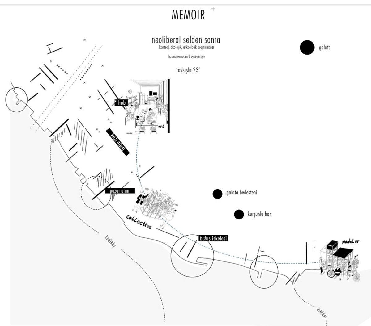
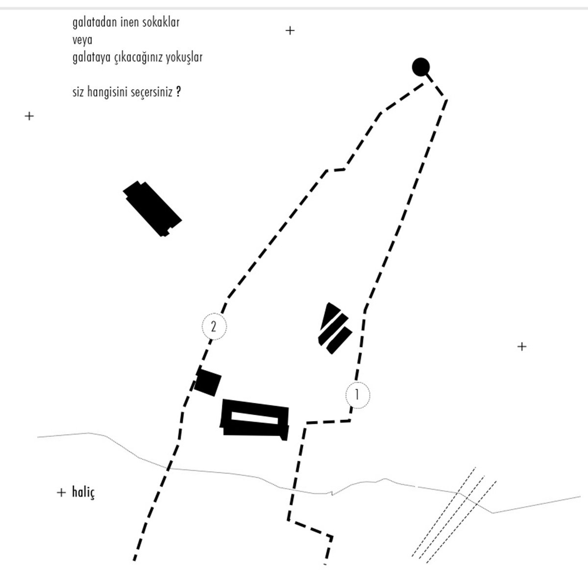
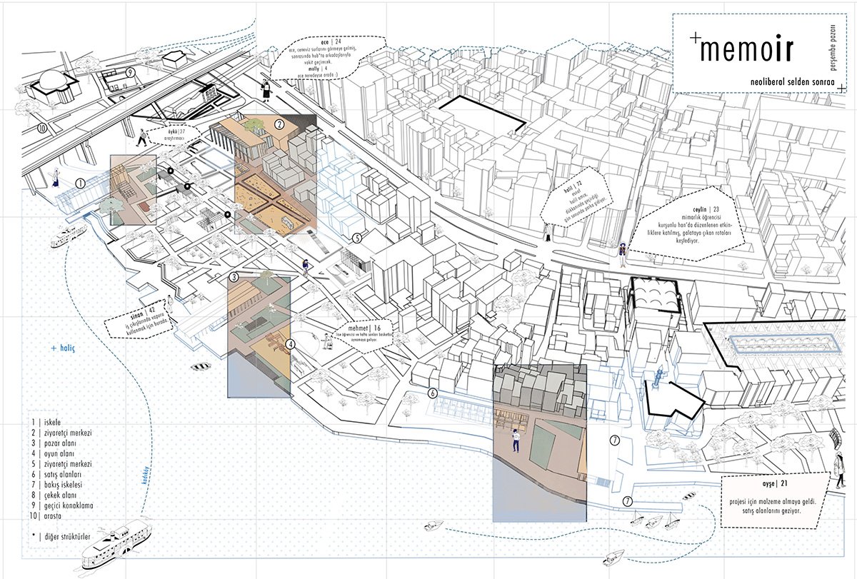
Initial large-scale spatial strategy sketch illustrating the upper-scale urban decisions. This drawing later became the cover of the final project booklet.Route diagram illustrating the user’s spatial experience from Galata toward the main intervention area, highlighting key landmarks and moments encountered along the way.Temporal urban montage illustrating the stratified history of Galata and Perşembe Pazarı, from early fortifications and commercial growth to 20th-century demolitions and shoreline alterations.
This project responds directly to the layered history and present conditions of Istanbul’s Perşembe Pazarı district. The site, with origins dating back to around 3000 BC, has long been defined by its relationship to the city walls, active trade networks, and vibrant everyday urban life. Over time, however, various demolition processes have disrupted this historic fabric and weakened the spatial continuity of the area.
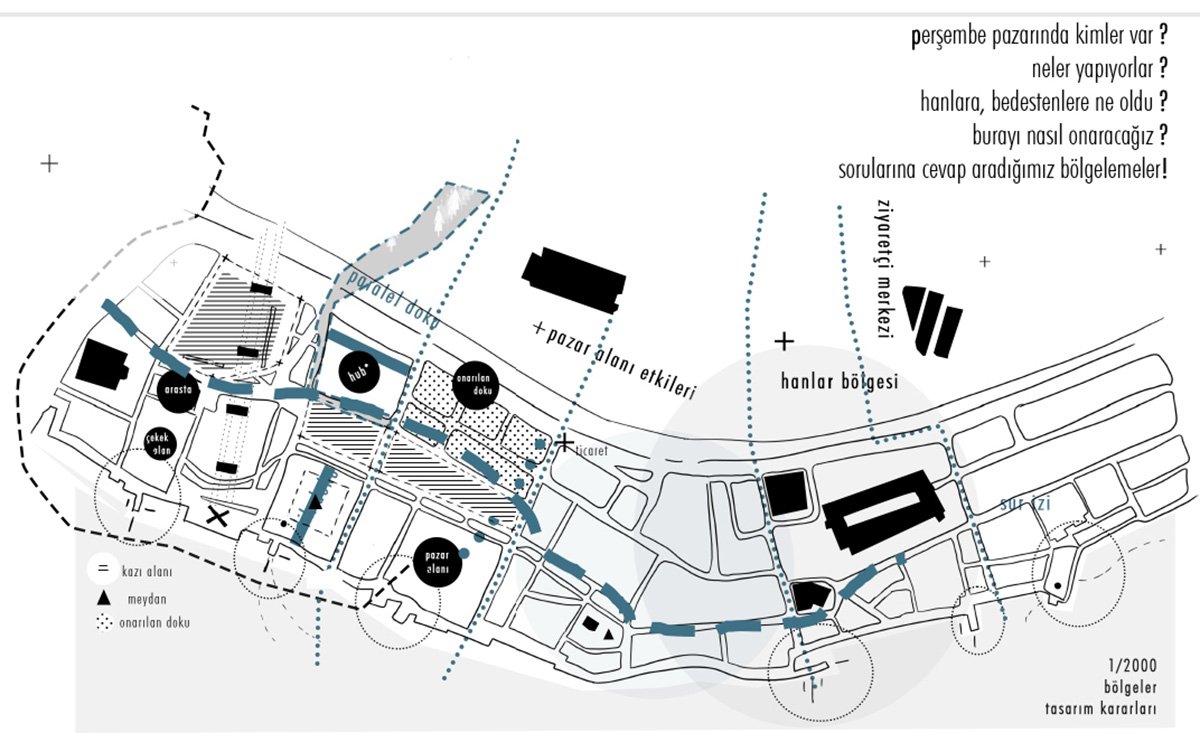
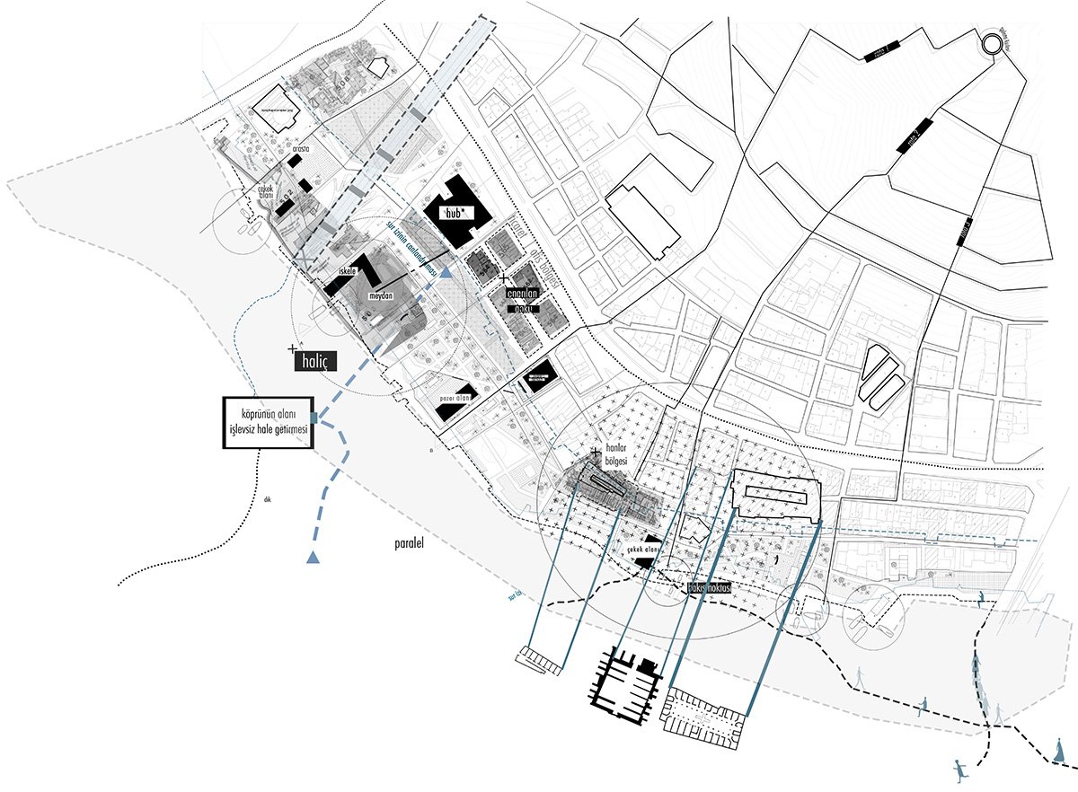
Urban morphology diagram generated from historical and current map overlays, tracing structural alignments, wall traces, and fabric transformations within the defined intervention zone.Large-scale planning decisions translating historical and morphological analyses into spatial zones, public connections, and strategic intervention nodes.
The proposal focuses on repairing and reactivating these fragmented site conditions. Key design strategies include restoring the trace of the historic city walls, reconfiguring the shoreline to strengthen its connection with the urban fabric, and introducing new structures that support the district’s daily commercial and social activities. Through these interventions, the project seeks to reconnect the site with its historical layers, revive collective memory, and reinforce the unique character of the district.
Design Process
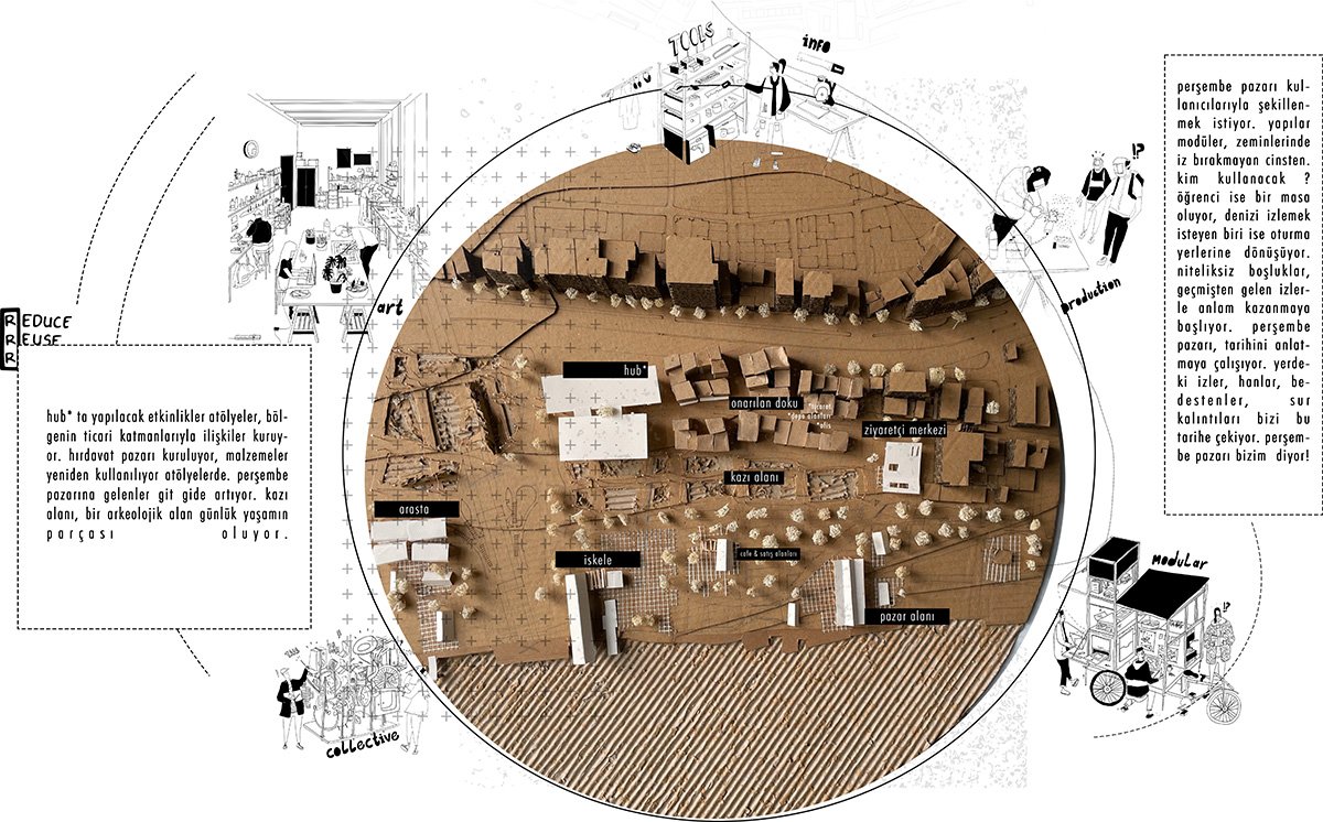
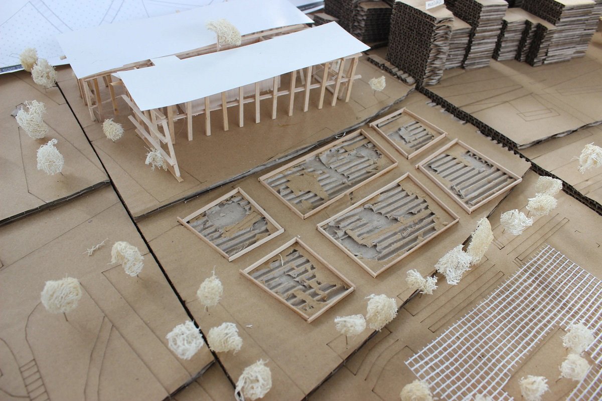
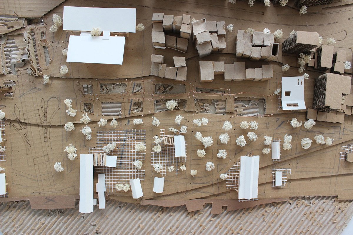
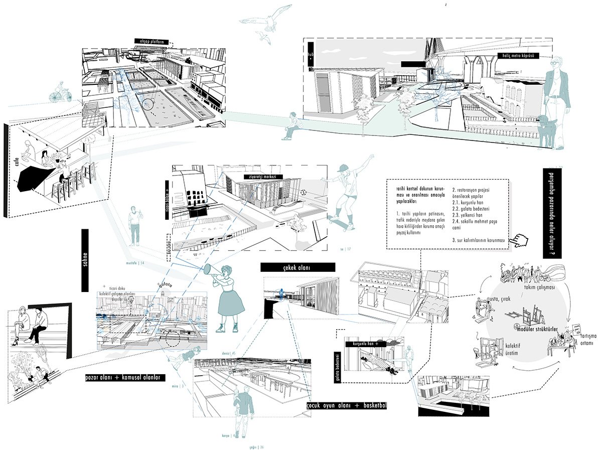
Final spatial proposal model demonstrating layered programmatic interventions, archaeological exposure zones, adaptive reuse structures, and newly defined public realms in Perşembe Pazarı.Socio-spatial mapping of primary user groups, highlighting their interactions, production patterns, and connections to ecological and urban systems within the project framework.
The design process began with an analysis of the historical and urban layers of Istanbul’s Perşembe Pazarı district, an area shaped by trade, everyday life, and successive demolitions that created fragmented urban voids.
Step 1: The district’s transformation was mapped by comparing key historical maps—Huber (1895), Goad (1904), Schneider (1944), and Suat Nirven (1949)—to identify references for the city-wall trace, shoreline, and built fabric.
Step 2: A central question was defined: how can the “void after the neoliberal flood” be reconstructed through collective memory and everyday life?
Model documentation demonstrating the spatial layering of archaeological exposure, structural grid systems, public open spaces, and contemporary architectural insertions along the shoreline.Detailed physical model illustrating the excavation strategy for uncovering wall traces, integrating protective framing systems and lightweight architectural structures to enable public engagement with the archaeological layers.
Step 3: Three spatial strategies were developed: (i) repairing the city-wall trace and distinguishing inside and outside urban fabrics through restoration of the trade tissue, (ii) rethinking the shoreline and redistributing piers to strengthen the city–water relationship and reduce congestion, and (iii) proposing an excavation zone that integrates existing wall remains to address the rupture caused by the metro bridge.
Step 4: Supporting programs—including a hub, visitor center, and modular open-space structures for market scenarios—were introduced to maintain pedestrian continuity and activate daily use.
Final Outcome
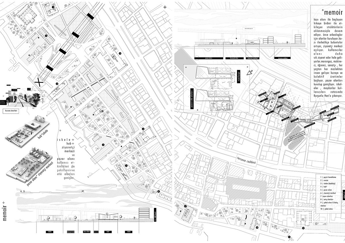
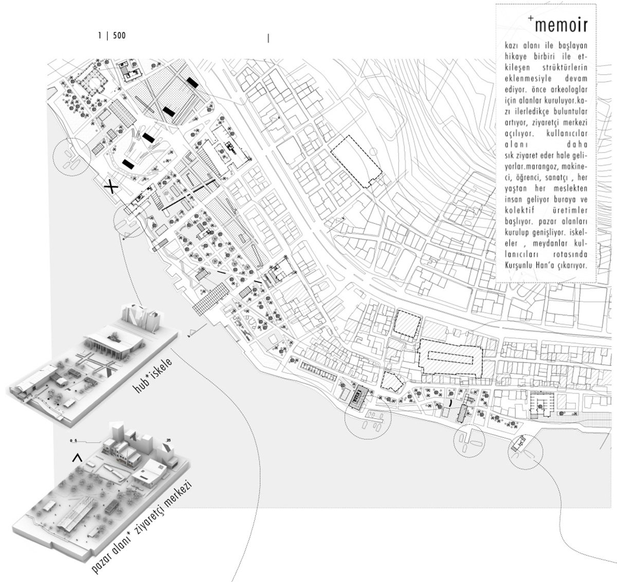
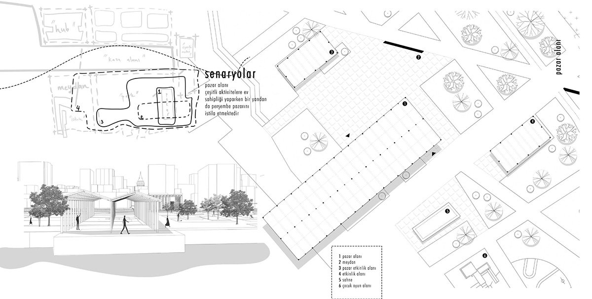
Urban-scale axonometric drawing demonstrating the spatial integration of excavation zones, adaptive reuse structures, market areas, visitor facilities, and public waterfront spaces within the dense fabric of Perşembe Pazarı.Strategic master plan demonstrating the integration of excavation corridors, market spaces, hub structures, han district connections, and reactivated waterfront edges within the dense urban fabric.Socio-spatial scenario diagram demonstrating the coexistence of production, restoration, public gathering, play areas, and waterfront activation within Perşembe Pazarı.
The final outcome of the project proposes a layered urban reconstruction strategy for Perşembe Pazarı, transforming fragmented voids into a continuous public landscape. The design restores the historical wall trace as a spatial and narrative spine, distinguishing interior and exterior urban fabrics while reactivating the trade-based identity of the district.
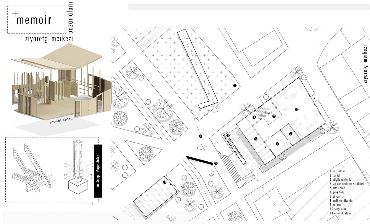
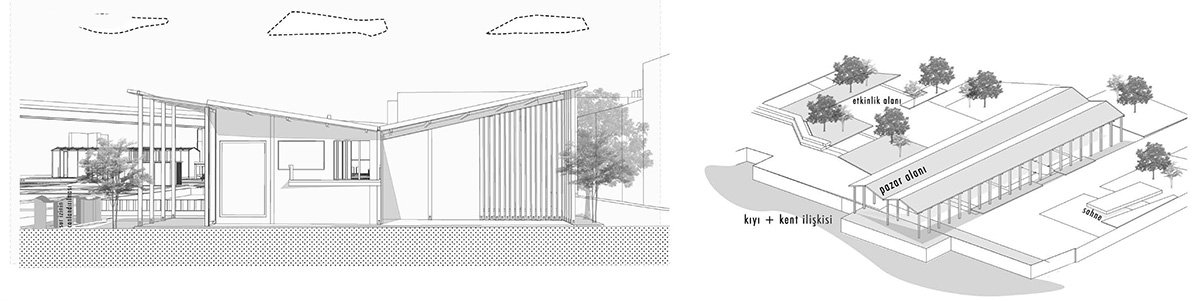
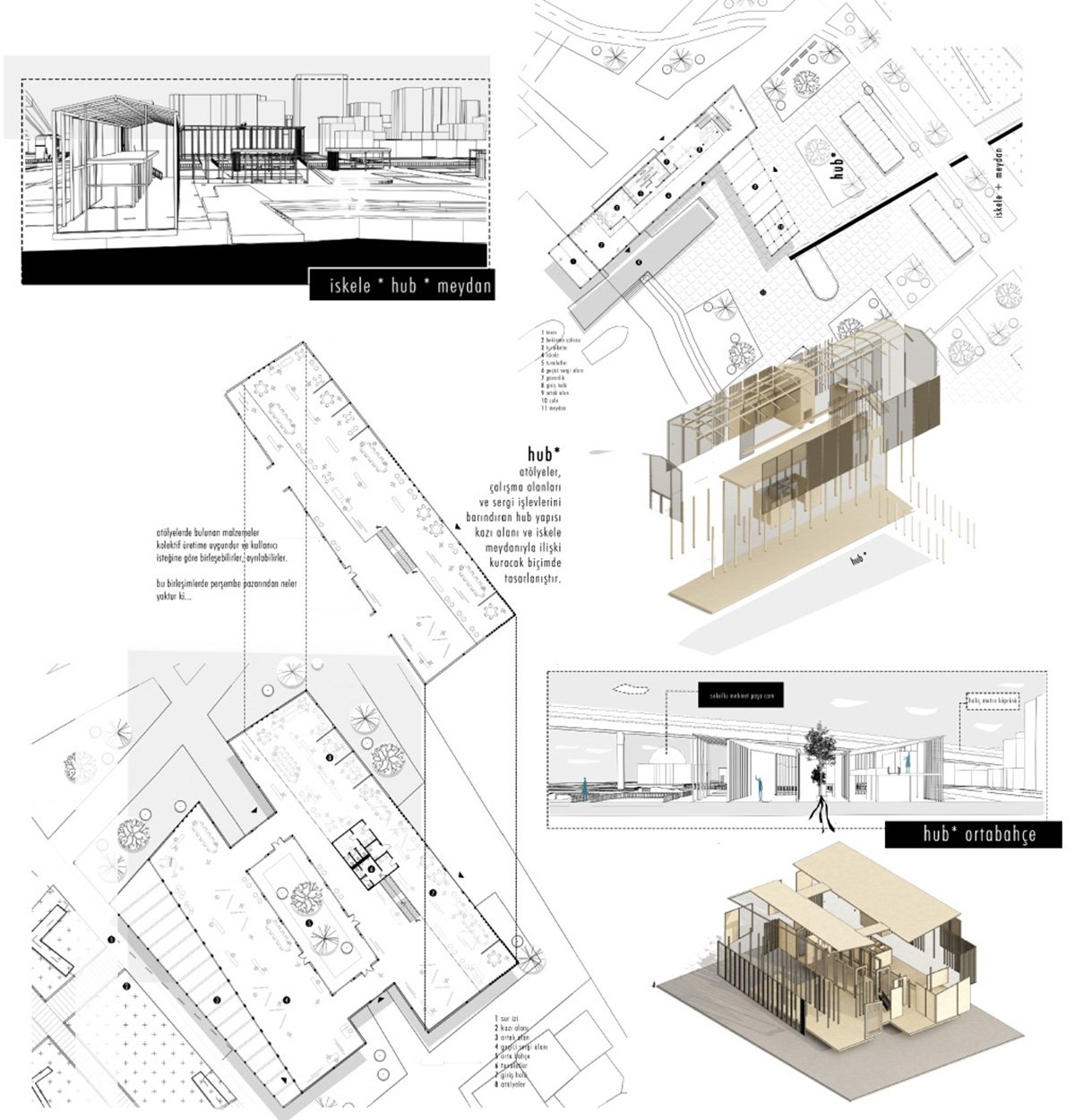
The pier, Hub, Visitor Center, and Marketplace – Plan and SectionsThe pier, Hub, Visitor Center, and Marketplace – Plan and SectionsVisitor Center Design
An integrated excavation zone incorporates the existing wall remains, transforming archaeological memory into an accessible public experience. The shoreline is redefined through distributed piers and pedestrian continuity, strengthening the relationship between the city and the water while reducing congestion.
Visitor Center DesignVisitor Center DesignThe pier, Hub, and Square Design
Programmatically, the proposal introduces a hub, a visitor center, and modular open structures that support market scenarios, workshops, and collective gatherings. These elements operate as light interventions within the existing tissue, allowing flexibility and adaptability over time.
Conclusion: The project ultimately reconstructs memory not as a static monument, but as an active urban condition shaped by everyday life, trade, and collective participation.
[This Academic Project has been published with text and images submitted by the student]
Site Context
Design Process
Final Outcome
To submit your academic project for publication at ArchiDiaries, please visit the following link >> Submit
Get the best of ArchiDiaries, directly in your inbox.
We use cookies on our website to give you the most relevant experience by remembering your preferences and repeat visits. By clicking “Accept All”, you consent to the use of ALL the cookies. However, you may visit "Cookie Settings" to provide a controlled consent.
This website uses cookies to improve your experience while you navigate through the website. Out of these, the cookies that are categorized as necessary are stored on your browser as they are essential for the working of basic functionalities of the website. We also use third-party cookies that help us analyze and understand how you use this website. These cookies will be stored in your browser only with your consent. You also have the option to opt-out of these cookies. But opting out of some of these cookies may affect your browsing experience.
Necessary cookies are absolutely essential for the website to function properly. These cookies ensure basic functionalities and security features of the website, anonymously.
Cookie
Duration
Description
cookielawinfo-checkbox-analytics
11 months
This cookie is set by GDPR Cookie Consent plugin. The cookie is used to store the user consent for the cookies in the category "Analytics".
cookielawinfo-checkbox-functional
11 months
The cookie is set by GDPR cookie consent to record the user consent for the cookies in the category "Functional".
cookielawinfo-checkbox-necessary
11 months
This cookie is set by GDPR Cookie Consent plugin. The cookies is used to store the user consent for the cookies in the category "Necessary".
cookielawinfo-checkbox-others
11 months
This cookie is set by GDPR Cookie Consent plugin. The cookie is used to store the user consent for the cookies in the category "Other.
cookielawinfo-checkbox-performance
11 months
This cookie is set by GDPR Cookie Consent plugin. The cookie is used to store the user consent for the cookies in the category "Performance".
viewed_cookie_policy
11 months
The cookie is set by the GDPR Cookie Consent plugin and is used to store whether or not user has consented to the use of cookies. It does not store any personal data.
Functional cookies help to perform certain functionalities like sharing the content of the website on social media platforms, collect feedbacks, and other third-party features.
Performance cookies are used to understand and analyze the key performance indexes of the website which helps in delivering a better user experience for the visitors.
Analytical cookies are used to understand how visitors interact with the website. These cookies help provide information on metrics the number of visitors, bounce rate, traffic source, etc.
Advertisement cookies are used to provide visitors with relevant ads and marketing campaigns. These cookies track visitors across websites and collect information to provide customized ads.